
„In this scenario the storm moves at the same speed as the waves it’s creating building energy into the waves as they travel. Of course create a large, powerful storm AND move it at the right speed and you can push things even further. This is what we’re set to see in the North Atlantic over the weekend.“ so magicseaweed über den Swell/Sturm des Jahres.
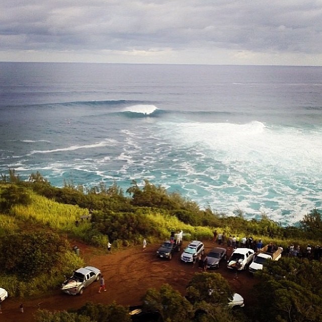
Noch hat der Swel nicht zugeschlagen, aber über die nächsten Stunden sollten sich die ersten Wellenberge Richtung Irland und Portugal schieben. Garrett McNamara wartet schon ganz nervös in Nazaré.
Habt Ihr schon einen Spot gefunden? Schickt uns Bilder, Tipps und Erfahrungen wo es am besten läuft!
Hier noch ein kurzer Spotbericht wo es laufen könnte:
Mullaghmore in Ireland looks to see some of the biggest swell its experienced in recent years, but with too much west in the wind and potentially frustrating NW conditions as the swell runs into day two. Ireland has a multitude of more sheltered spots, however, and both Northern Ireland and spots all the way round to the sheltered east coast will see more manageable swell with those same strong winds offshore in some locations.
England and Wales experience significant swell with those same tricky winds but with a rugged coastline that’ll mean shelter and reasonable waves in the right places.
In South West France the swell is of a size for only the most robust of breaks to handle. Belharra is forecast to peak at an intense 14ft@19seconds but again with a wind that’ll make most of the coast un-contestable. Look for the best conditions post-peak.
Northern Spain sees a similar size and with a northerly angle that’ll mean the swell finds every little sheltered spot and at a size too large for many of them, winds are more likely to be strong off or cross shore on this section of the coast and no doubt there’ll be some interesting surfing options for the committed.
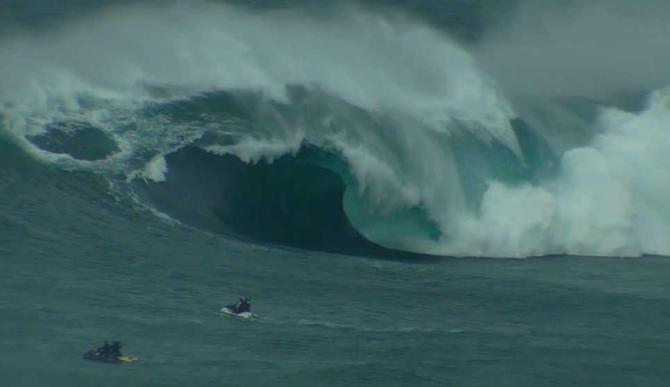
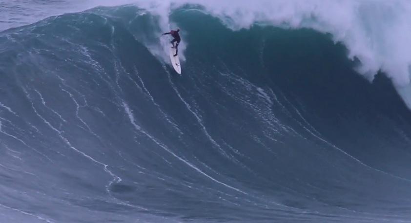
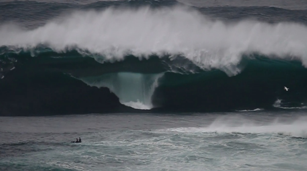
Portugal starts to look most interesting. With that northerly swell direction breaks like Supertubos and Carcavelos will pull out some of the power and a predicted northerly wind could offer some great conditions as the swell peaks at around 15ft@17seconds. At Nazaré we’re looking at swell into the XXL range but here we see a strong North Westerly or Northerly wind that won’t make for perfect conditions. “There are going to be be waves at Nazaré on Monday, but the wind could be a problem.” Says man on the ground, Dino. “Either way it will be an amazing show to watch such a powerful swell arriving at Praia do Norte”
Morocco is going to absolutely pump. 10ft@18seconds hitting the point breaks of Taghazout at peak and located far enough south to avoid the tricky winds generated from this storm. Strong currents will be an issue at many spots
Mehr dazu hier: magicseaweed.com/news/European-Storm-Call
Share